Saturday, October 18, 2008

Cachagua Fire's Pride...

October 18, 2008...

"Guys, I'm hoooo-ome!!"

This just in from Chief Skee Stanley of Cachagua Fire:
Cachagua Fire Protection District has a new (used) engine. The District purchased a Boise Mobile Equipment Engine from Mt. Jackson Fire Department in VA. 

The new E-7731 has 28,000 mile on her, 500 gallon Poly tank, 1,000 gpm pump w/ pump and roll capabilities. 

E-7731 will be at West-Mark in Ceres, CA for the next 30 days for some modifications and a complete service. I estimate the the new E-7731 will be in service by 12.01.2008. 

Yes she will be painted red and we will be keeping the white hood and cab top.

Congratulations to Chief Stanley and Cachagua Fire!!!

Friday, October 3, 2008

On travel to the East Coast through 10/5...

Hi, gang! 

I'll be doing limited posting due to being on the road, and nowhere near the Chalk Fire action, through Sunday, 10/5... 

Back in the saddle on Monday the 6th. 

All the best to our friends in Big Sur South and KUSP listeners!

Kelly

Tuesday, September 30, 2008

The Scoop from Skee...

September 30, 2008, about 8:00 pm

Chief Skee Stanley of Cachagua Fire sent me a screen dump of the data he sees from his ICS Summary screen. Here's what it looks like"

209 as of 18:00, 9/30/08...

Incident Status Summary (ICS-209)
Date 09/30/2008 
Time 1800 
Incident Number: CA-LPF-002754
Incident Name:  CHALK
Incident Kind:  Wildland Fire
(Full Suppression/Perimeter Control) 
Start Date Time: 09/27/2008 2002 
Cause Under Investigation
Incident Commander: Jim Smith
Incident Command: Organization Type 2 Team 1
County: MONTEREY

Latitude and Longitude 
Lat: 35° 59´ 25" 
Long: 121° 25´ 48"
Ownership: CA-LPF 

Short Location Description (in reference to nearest town): 
22 miles Southwest of King City, Ca
Size/Area Involved: 3,453 ACRES
% Contained or MMA: 8 Percent
Line to Build: 762 Chains
Estimated Costs to Date: $1,800,000
Structure Information 0 Threatened 1 Damaged 0 Destroyed 

Threat to Human Life/Safety:
Evacuation(s) in progress: Yes
Potential future threat: Yes
No likely threat --------------- Residence 12 0 0
Commercial Property 1
Outbuilding/Other 12 0 0

Projected incident movement/spread 12, 24, 48, and 72 hour time frames:
12 hours: North, South, and East
24 hours: North and East
48 hours: Same
72 hours: Same

Values at Risk: include communities, critical infrastructure, natural and cultural resources in 12, 24, 48 and 72 hour time frames:
12 hours: Ventana Wilderness. Condor habitat range and Steel Head habitat in Mill Creek. Residences
24 hours: Same
48 hours: Ventana Wilderness. Condor habitat range.
72 hours: Same

Critical Resource Needs (amount, type, kind and number of operational periods () in priority order in 12, 24, 48, and 72 hour time frames):
12 hours: Type 3 engines.
24 hours:
48 hours:
72 hours:

Major problems and concerns (control problems, social/political/economic concerns or impacts, etc.) Relate critical resources needs identified above to the Incident Action Plan.

Access to the fire is a concern with steep rugged terrain. Fire is burning in the Ventana wilderness and evacuation order is in place.

Observed Weather for Current Operational Period
Peak Gusts (mph): 6 
Max. Temperature: 85
Wind Direction: SW 
Min. Relative Humidity: 20 
Fuels/Materials Involved: 4 Chaparral (6 Feet)
Large volume of dead and down material in fire fuel bed. Oak woodland and pockets of timber. No prior recorded fire history in area of involvement.

Today's observed fire behavior (leave blank for non-fire events):
Occasional slope runs, moderate rate of spread, rollout pushing fire down slope.

Forecasted Weather for next Operational Period
Wind Speed (mph): 1-3 
Temperature: 68
Wind Direction: SW 
Relative Humidity: 30

Actions planned for next operational period:
Continue to construct and improve line, contingency line construction, structure protection.

For fire incidents, describe resistance to control in terms of:
1. Growth Potential - High
2. Difficulty of Terrain - Extreme

Remarks:
Acreage increase is over a 24 hour burn period. Accurate data was not available at post time. This incident will be in unified command with Fort Hunter Liggett at 0600 10/01/08. 11 people advised to evacuate in Dempsey Flat area, and Beiar Property

The Plume from Corral de Tierra through Salinas Valley...

(Salinas Valley - Corral de Tierra (on the left) to Big Sur South (on the right), panorama shot... click to expand)

September 30, 2008 about 11:30 am...

The extent of the smoke plume speaks to this morning's fire activity...

The Plume from the Corral de Tierra side...


(Corral de Tierra side of Laureles Grade(on the left) toward Big Sur South (on the right), panorama shot... click to expand)

September 30, 2008 about 11:30 am...

Here's the plume on the Corral de Tierra side of Laureles Grade... next one up will show the continuation of this  to the right, over Salinas Valley.


Same Old Shot, Different Day....

(Carmel Valley side of  Laureles Grade toward Big Sur South, panorama shot... click to expand)

September 30, 2008 about 11:30 am...

Having left Jamesburg behind to go to work in Monterey, I notice the scent of smoke and a slight ashfall all the way into town.

On Laureles Grade, The plume formed over the fire looks big! And with the wind shift to the northeast, the plume is extending through Corral de Tierra and into Salinas Valley, then out over Monterey Bay.

Big Sur Kate tells me that the thing went on a "run" - firespeak for the fire beginning to accelerate and take off.

Citizen On-ground Reporting...

September 30, 2008 about 8am...

During the Basin-Indians Fires, the early IC teams were not really fond of citizen reporters. "These blogs" - as we were referred to - "are inaccurate" they were often heard saying.

On this side of the chaparral, it was refreshing... no, absolutely INVIGORATING... when IC Jeanne Pincha-Tulley showed up. 

Chief Jeanne, rather than circling the wagons and telling her PIOs to keep these locals at bay and out of the way, instead reached out to the local channels of communication. 

Among fire officials, the word out about Michael's blog, Cachagua Store, our local-flavor periodically-updated journal, filled with acerbic wit and wisdom was that it was parlous, at best.

Jeanne showed up for a cuppa' on Michael's front porch at the store... kudos to the Chief for behavior  above and beyond the call.

For my part, Jeanne invited me to record an interview with her, updating the status of the fire, every morning, which we made available on KUSP's website.

Now, with the Chalk Wildland Fire, Kate Novoa, Big Sur Kate, has taken the lead with her excellent job of reporting, from her house just 4 miles from the fire.

As of 9:00 am this morning, Inciweb hasn't updated this incident for the past 13 hours. Contrast this with the information on Kate's 'blog, and you'll see the value of well-written, up-close, unopinionated citizen reporting.

Writing a 'blog in service to the community is fun, exciting and satisfying... but, Kate - and I - have "real jobs" and when a 'blog 'takes off" and becomes the "go to" source of incident information, it can take over your life as people begin to count on your service.

Now and then, you get an email or a phone call from someone worried sick about their friends, their family, or just simply, their memories of a beautiful part of the world, now under threat. It's wonderful to know that the information you provide has made a difference... in a sense, it feeds, in part, a 'blogger's addiction... that and an insatiable desire to learn, understand and tell the human side of the tale.

Kate's in the middle of that kind of expectation right now. She deserves every bit of credit and thanks from those of us who have interest, lives and property at stake.

Accurate, well-written, on-scene citizen reporting is part of our information landscape... it's not going away in the near future. On the contrary, it's a "craft" - a developing, volunteer craft - which, in these days of "embedded" journalism and information "spin," can be, and often is, a definitive and vital font of information in a suite of information sources.

Let's welcome such reporting to the party.


Monday, September 29, 2008

From the front line on the Chalk Fire...

September 29, 2008 about 6:00 pm...

Our good friend and neighbor, Chief Skee Stanley of the Cachagua Volunteer Firefighters sent this from the too-close-for-comfort seat of the Chalk Fire front lines:
Just spoke with my lead dozer operator Terry Bishop who says:
"We are going to be on this fire for awhile"
On another note, I got a call from Mike Kremke (USFS-LPF Division 1). Chief Kremke requests the Cachagua Fire Protection District to staff up a type 3 engine for coverage of the northern area of the Los Padres National Forest per our contract with USFS - LPNF.
CFC Engine-7732 with a crew of three to four firefightes, Battilion Chief J. delValle (B-7702) will have adminstrative coverage for the Northern end of the LPNF.
I ran into Chief Jaime delValle yesterday on Tassajara Road, and he mentioned that that the fourth dozer went down to Big Sur today... proud of his homeboys, Papa Skee signs his missives this way:
Another example of what CFC Volunteers can do and have done.
Any Assignment
Any Where
Any Time
CFC will get the job done Safely!


Skee
Skee Stanley
Fire Chief
Cachagua Fire Protection District
Go get 'em!!!  And thanks Cachagua Volunteers, once again, for watching our back!

Sunday, September 28, 2008

The Chalk Wildlands Fire Plume from Carmel Valley

(panorama shot, click to enlarge... it's wiiiiiiiiiide!)

September 28, 2008 about 6:45pm...

Upon leaving our house in Jamesburg this evening, we noticed some ashfall on our car... curious, I thought!  That fire's still 27 miles away!

Well, when we got to Laureles Grade, here's the view looking south. This is not a small fire, and the word is that the crews expect containment on October 10th... in other words, it's not just a walk in our park!


Chalk Peak Fire near Pacific Valley, Big Sur...


Sunday, September 28, 2008 about 8:30am ...

Big Sur Kate, who lives and blogs from Pacific Valley, is reporting a new fire, just about out her back door.

It seems to have begun around 9 pm last night and it was estimated to be about 25 acres at the time. 

As of this morning, evacuations have been ordered in the Pacific Valley area, near the fire. The extent of the evacuation area is not yet clear. 

According to Kate and other sources, USFS wildland fire vehicles are on site and aircraft can be heard nearby.

The Modis map (click to expand the image), above, is from this morning and it shows a number of hot spots. The ones to the left are - presumably - near the origin of the fire, while those to the right are about two miles east.

There is no incident yet declared on Inciweb, but stay tuned to Kate's Blog for on-ground information, as long as she can do so safely.

Here's a recent post from Kate's blog:
9:30 am - initial attack reports LP hots spotted headed this way early this am. Also reports: “BEU sent 1 engine strike team, 2 single increment engines, 3 crews from Gabilan Camp, 1 chief officer, 2 air tankers, C-406. Good header showing from King City with drift smoke going to the north. Mid 90’s expected today. Fire is on the south side of Naciemento Ferguson Rd. off the South Coast Ridge Rd, both sides of the South Coast Ridge Rd. have fire on it. Last update I heard was 20-30 acres. Smoke column looks like it might be a little larger than that.”
--------------------------------------------------------------------------------------------
Sunday, September 28, 2008 about 10:15am ...

This just in from BSVFD Chief Frank Pinney (through a 3rd party source):
FYI, we are standing by at this time on the South Coast with structures threatened by a 200-300 acre active fire near Pruitt Ridge, just about to South Coast Ridge Road. USFS has crews on it since about 9PM last night and incoming resources this morning.

Frank
---------------------------------------------------------------------
Sunday, September 28, 2008 about 2:15pm ...

Big Sur Kate is the go-to woman on this fire... her blog has in-yer-face photos - literally! - since the fire is providing a show for people watching it from her place (she's even done up some popcorn!).

InciWeb has the fire up, at last. Listed as the "Chalk Wildland Fire" just click and you'll go there, if it's not "that time of the month" for InciWeb!

From Kate's latest on her blog:

And this just in from the (U.S. Forest Service) PIO: 
“The Chalk Fire is now on Inciweb. Info from the field is sketchy at this point, but should improved later this afternoon/early evening when the arrival of the Type 2 Incident Management Team and additional PIO’s. We have a field PIO (Rich Phelps) in the area right now, however cell phone coverage is poor. We have only two phone lines open in the Goleta Information Center so would prefer everyone check inciweb.org. As we receive new confirmed information we will post it on Inciweb….

Kathy Good
Public Affairs Officer
2:00 pm - just spoke w/ Kathy Good. Jim Smith and his Type II IC team is on the way, and additional information should be available once the situation is evaluated.

2:30 pm - Roberta, of the USFS is asking all children to leave the area, according to Alicia. Keith Harlan reports what sounds like an evacuation “warning” (preparation, only) for Lucia and the Hermitage.

Here's what InciWeb's got at the moment:


INCIDENT UPDATED 33 MIN. AGO

Summary

The Chalk Fire started at approximately 7:30 p.m last evening and has now burned 500-600 acres. The fire is located just to the north of Chalk Peak, approximately 22 miles south west of King City, in the Monterey County section of Los Padre National Forest. The fire is burning in oak and brush west of Chalk Peak and South Coast Ridge Road and is on both sides of South Coast ridge Road. By 1:00 p.m. this afternoon, the fire had crossed Nacimiento Ferguson Road and is currently burning on both sides of the road. The fire is currently very visible, as it is generating a large column of smoke.

Cause of the fire is under investigation.

Road closures: Nacimiento Ferguson Road is closed at Highway-1 on the west side and at the forest boundary on the east side. South Coast Ridge Road is closed at Nacimiento Ferguson Road and Highway-1 at Plaskett Creek.

Evacuations: As a precautionary measure, 3 national forest campgrounds southwest of the fire have been advised to evacute. Other rural residences and private inholdings may need to be evacuated.

Resources either on scene or ordered: 7 helicopters, 8 air tankers, 1 lead plane, 1 air attack aircraft and 10 engines.

And this just in from Chief Skee Stanley of Cachagua Fire:
At Noon today Cachagua Dozers 7755, 7756 and 7757 are enroute to the Incident. D-7758 will be enroute on Monday morning.

Skee


And here's the fire map!!


Monday, September 8, 2008

What about a Municipal Advisory Council?

September 8, 2008 about 7:30 am...

At a recent Big Sur MAAC meeting, Congressman Sam Farr brought to my attention the provision in California law that allows for an entity called a "Municipal Advisory Council" or MAC.

The purpose of such a group is to allow a community to "advise" the county supervisors on what the community's needs are and through this method, get a "seat at the table" gain some local "clout" and garner funds, via grants, etc... otherwise-unavailable to individuals.

Shall we consider asking Dave Potter's office to sponsor a Jamesburg-Cachagua Municipal Advisory Council? Is anyone interested in forming such a group? What are the pros and cons of this in our area?

Unlike "Incorporation" or the formation of a "Service" or "Fire" district, we would not need LAFCO approval, nor would it cost anything to do this.

Here's the citation:
Municipal Advisory Councils

(Excerpt from California Government Code Section 31010)

DIVISION 4. EMPLOYEES

PART 1. EMPLOYEES

31010. The board of supervisors of any county may by resolution establish and provide funds for the operation of a municipal advisory council for any unincorporated area in the county to advise the board on such matters which relate to that area as may be designated by the board concerning services which are or may be provided to the area by the county or other local governmental agencies, including but not limited to advice on matters of public health, safety, welfare, public works, and planning. Unless the board of supervisors specifically provides to the contrary, a municipal advisory council may represent the community to any state, county, city, special district or school district, agency or commission, or any other organization on any matter concerning the community. The board may pay from available funds such actual and necessary expenses of travel, lodging, and meals for the members of the council while on such official business as may be approved by the board.

The resolution establishing any such municipal advisory council shall provide for the following:

(a) The name of the municipal advisory council.

(b) The qualifications, number, and method of selection of its members, whether by election or appointment.

(c) Its designated powers and duties.

(d) The unincorporated area or areas for which the municipal advisory council is established.

(e) Whether the establishment of the council should be submitted to the voters and the method for such submission; provided that if an election is required pursuant to subdivision (b), such election shall be held at the same time as an election held pursuant to this subdivision.
(f) Such other rules, regulations and procedures as may be necessary in connection with the establishment and operation of the municipal advisory council.

(Added by Stats. 1971, Ch. 348; Amended by Stats. 1975, Ch. 336; Amended by Stats. 1978, Ch. 41.)

______________________________________
Links to some existing MACs...


______________________________________
Example of a MAC for an unincorporated area...

LODI NEWS SENTINEL
July 18, 2002
Lockeford to hold first MAC meeting tonight

By Ross Farrow/News-Sentinel staff writer

Today will be a historic occasion with the first-ever meeting of the Lockeford Municipal Advisory Council.

The seven-member council will advise San Joaquin County officials about issues covering public works projects, public health, safety, welfare and land-use issues in the Lockeford area.

The council consists of temporary chairman Timothy Fowler along with Robert Marty, Lani Eklund, Peter Bregman, Don Litchfield, Chris Littlefield and Roy Wales.

"We hope to be the spokespeople for the community and hope to have a little more clout than individuals would," said Bregman, a certified and financial planner who has lived near Highway 88 and Kettleman Lane since 1978.

"I hope it will be a voice for the community and help to shape the community so that we can live in Lockeford and enjoy the reasons we moved to Lockeford," said Eklund, co-owner of the historic Inn at Locke House on Elliott Road.

The council's inaugural meeting will begin at 7 p.m. today at the Lockeford Community Center's McDonald Building, 19456 N. Jack Tone Road. Monthly public meetings will be held on the third Thursday of each month.

In addition to electing officers, Fowler has placed four items on the MAC's first agenda:

A report by Chris Locke, a Lockeford Community Services District board member, on plans for Lockeford's first park. It could be built on 10.21 acres the district purchased this year from the pioneer Hammond family on Tully Road, just south of Lockeford Elementary School.

What can be done with the large abandoned building at the northwest corner of Highway 88 and Elliott in the heart of Lockeford's business district.

A tentative subdivision map for Lockeford Vista, Unit 2, a proposal for about 34 homes on the south side of Highway 88 in the eastern end of town. The Lockeford Vista developer, however, has not acquired water and sewer rights, according to Joe Salzman, general manager of the Lockeford Community Services District.

Plans for traffic signals on Highway 88 at Victor Road and on the highway at the Tully/Elliott road intersection.

Two more stop lights are planned on Highway 88, one at Victor Road and another at the intersection of Tully and Elliott roads. Bregman said he wants to make sure Caltrans' plans don't become delayed like they have in the past.

Fowler said a Caltrans representative is scheduled to attend the MAC's Aug. 15 meeting.

Fowler noted the need for more traffic safety in light of two major accidents that took place in the Lockeford area during the past week. One was a fatal truck-pedestrian accident on Highway 88 near Victor Road, and another crash at Elliott and Highway 88.

"That's somewhat of a frequent occurrence," Fowler said.

Bregman said he hopes a municipal advisory council in Lockeford can encourage important projects like traffic lights on Highway 88 to be accelerated.

He said he has witnessed many severe traffic accidents near his residence at Highway 88 and Kettleman Lane, yet it took until last fall to have a traffic light installed at that intersection.

Municipal advisory council at-a-glance
A municipal advisory council consists of residents within a community's boundaries who will advise San Joaquin County officials about issues of interest within the community.
Issues will include land use, public works projects, public health, safety and welfare.

The Lockeford Municipal Advisory Council boundaries extend north to the Mokelumne River, west to Tretheway Road, south to Kettleman Lane and east to Tully Road between Kettleman and Brandt Road. North of Brandt, the eastern boundary is Disch Road.

Lockeford becomes the fifth community to have a municipal advisory council established by the Board of Supervisors. The others are Woodbridge, Morada, Linden and French Camp. Beginning in 2004, the council seats will be elected positions.

The Lockeford MAC consists of seven people who live within the council boundaries.
Timothy Fowler, council president for tonight's meeting, has owned for seven years an arbitration business in Lockeford, where he handles real estate disputes, medical disputes with insurance companies and negotiates debt settlements with businesses in debt.

"I try to keep the parties from going into court," Fowler said. Fowler has also owned Computer Bob's on Highway 88 in Lockeford for two years. Born and raised in Lodi, Fowler was a building contractor for 25 years before deciding to get out of the business. He spent 10 years in Amador County before moving to Lockeford four years ago. 
He was project coordinator for the Lodi Veterans Plaza project and is vice president of the Veterans Plaza Foundation.

Sunday, September 7, 2008

Community Emergency Response Team....

September 7, 2008, about 10 am...

As we move forward in the Jamesburg and Cachagua community to develop our own citizen's emergency action group, we might find useful a program called Community Emergency Response Teams (CERT) offered without charge by "Citizen Corps" which is a program sponsored by FEMA, which is of course, under the U.S. Department of Homeland Security.

Here's what their webpage says about the CERT program:
The Community Emergency Response Team (CERT) Program educates people about disaster preparedness for hazards that may impact their area and trains them in basic disaster response skills, such as fire safety, light search and rescue, team organization, and disaster medical operations. Using the training learned in the classroom and during exercises, CERT members can assist others in their neighborhood or workplace following an event when professional responders are not immediately available to help. CERT members also are encouraged to support emergency response agencies by taking a more active role in emergency preparedness projects in their community.
The CERT program is well-developed and free of charge. If we wished to start a Jamesburg and Cachagua CERT-based program, here's a link that suggests the steps that a community group takes in order to do so.

Supervisor Dave Potter has already offered the service of his office to assist (the CERT program asks for a local elected leader to sponsor the local program, so this would be a perfect first-use of the supervisor's resources).

If you'd like to get an idea about what the training materials are like, you can try out a few by following this link.

________________________________________________
The Big Sur NERT Concept...

In addition to CERT, a while back, while attending one of the Big Sur Multi Agency Advisory Meetings (BSMAAC), Penny Vieregge, a long-time time, active and respected resident of Big Sur, brought up an effort, mounted in 1996, to address local fire preparedness. 

Chief Frank Pinney also chimed in, in support of revisiting the Community Emergency Response Plan, of which he was also a part.

Here are some notes, provided by Peggy, from the previous program. The plan is a 5-module approach, which involves Disaster Emergency Training provided by the Red Cross in order to create a context for emergency preparedness.  But, it doesn't stop there...

The plan assumes that neighborhood groups, or "enclaves"- any small, distinct area or group enclosed or isolated within a larger one, will identify and address it's own distinct needs. 

For example, in our area, an enclave could be as "broad" as Jamesburg and/or Cachagua, or as discrete as Trampa Canyon, Chews Ridge, Princes Camp, Sky Ranch, and the like.

The enclaves are as we define them... we simply want the delineations to make practical sense.

The enclaves will communicate with each other in an emergency and in non-emergencies, they'll maintain and enhance their preparedness, periodically.

Here are some of the features of the Big Sur plan ("NERT" - a predecessor of "CERT" are conceptually the same):
  • Identification of enclaves with mapping, communications, safe areas and evacuation routes for Coastlands (Upper, Middle and Lower Roads) and Pfieffer Ridge (upper and lower). Areas, from Palo Colorado south to the County line identified by watershed, access roads, alternate escape routes
Three training frameworks in preparation, responding and recovery in place: 
  • Module I - Self and Family
  • Module II - Neighborhood; and, 
  • Module III - Community

Module I
Training provided by American Red Cross (ARC) - Intro to Disaster 
  • Neighborhood Emergency Response Team (NERT) - Disaster Awareness Personal
  • Family
  • Workplace

Training Provided by NERT
  • Emergency Response Team

Training provided by ARC
  • Disaster Action Teams 
  • Incident Command System from Family to State 

Training provided by ARC and NERT -
Family Planning for:
  • Fire/Flood 
  • Road closures 

Module II
Communications
  • Within the family 
  • Within the enclave
  • With command agency 
Info Updating
Documentation

Module III
ARC /NERT - Disaster Psychology
  • Windup after Disaster 
  • Recovery Re-occupation Safety, 
  • Hazard Assessment Available agency assistance debriefing 
  • Re-assessment of planning 

Module IV 
Trained enclaves to meet with professional agencies for a review of:
  • Safe areas
  • Evacuation/staging areas
  • Introduction of enclave leaders (based on the ICS)
  • Inventory list exchange; and, 
  • Communications methods, protocols and contacts

Monterey County Agency Contacts

September 7, 2008 about 9:30 am...


Monterey County Contacts for Fire Recovery Questions: 

Planning Department Questions: 

Coastal Zone 
Joe Sidor (Primary) 755-5262
Carl Holm  755-5103
Laura Lawrence  755-5148
Mike Novo  755-5192 
Inland Areas
Ramon Montano (Primary) 755-5169 
Taven Kinison Brown 755-5173 
Jose Luis Osorio  755-5177
Carl Holm  755-5103 

MoCo Website Links: 

Monterey County website links to other organizations
Links to NonProfit Organizations
Links to Government Organizations
Applications for Rebuilding, Monterey County website

Erosion Control Information, Monterey County website

Monterey County Fire Information website

Building Services Department Questions 
Wanda Hickman: 755-5285 
Albert Salvador : 755-5191 

Health Department Questions (Water Systems, Hazardous Materials, Waste) 

Reception : 755-4505 

Office of Emergency Services (Disaster Assistance) 

Individuals and Businesses: Rob Clyburn: 796-1902 
Non Profits and Agencies: Phil Yenovkian: 796-1904 

Natural Resources Conservation Service (technical assistance for private lands) 
Salinas Office: 424-1036
Robert LaFleur: extension 101
Danny Marquis: extension 115 

US Forest Service (questions relating to Forest Service land) 

King City Office: 385-5434 


State Parks (questions relating to State Parks land) 
Monterey District Office: 649-2836 

Ever Wonder What the Cobra Pilot Sees??

September 7, 2006 about 7am...

Video from Wildfire Event on the Klamath River

If you read this blog regularly during the Basin Complex Fire, you may remember that we spoke about the Bell Cobra Helicopter, based in King City, outfitted with InfraRed instrumentation and from high altitude, used to search for "hot spots" in the fire zone.

In 1996, the U.S. Army retired 25 of its Cobra combat attack helicopters. 

The Forest Service got them, refitted them with a bunch of useful things and called them "Firewatch" helicopters.

High-flying and fast, their purpose is to relay information about the direction and strength of a fire to ground crews and to help larger planes make accurate water or fire-retardant drop by providing precise GPS coordinates.

Also on board is an infrared thermal imager capable of detecting the heat of a wildfire through thick smoke (see video, above). Its low-light and color cameras can pick up fine resolution images of the fire, and then its transmission equipment can send those images—in real time—to firefighting crews up to 30 miles away.

Thursday, September 4, 2008

Community Meeting, Cachagua Community Center 9/3/08...


September 3, 2008, about 6:00 pm...

The Community Meeting at Cachagua Community Center this evening, was in the overall, positive and fruitful.

Hosted by Congressman Sam Farr and 5th District Supervisor Dave Potter, the meeting, drew a raft of agency representatives, including Monterey County Sheriff Mike Kanalakis and his staff, the CHP, MoCo OES, Building, Environmental Health, Natural Resources Conservation Service, CalFire, Cachagua and Carmel Valley Fire, the U.S. Forest Service, SPCA others.

I, for one, was pleased to see the Sheriff present, as, I think, were many residents, since more than a few were non-plussed about the performance of the Monterey County Sheriff's deputies, and Chief Kanalakis himself, during the evacuation events.

John Russo (shown in the picture, above), Greg Scherman, (the unofficial "Mayor of Jamesburg") and a number of other residents aired their experiences, points of view and displeasure; but, ultimately - and this is the encouraging part - many agreed that it is time for and active group of residents to organize in order to identify resources, lines of communication, work with local representatives and authorities and vie for a seat at the Incidnet Command table, when the next disaster strike Jamesburg Cachagua.

For their part, agency representatives appeared to be willing to assist in any way they can.

If you wish to be a part of forming and developing a Community Emergency Response Team, please call (831) 659-2320 or email me: kellyeo@mac.com

Our thanks to all the agency representatives in attendance, and to Sam Farr, Dave Potter and Kathleen Lee, and John Russo for helping to put together this meeting; and, of course, many thanks to our good friends and neighbors in the Cachagua-Jamesburg area.

Audio from the meeting can be found HERE and on KUSP's website.

Tuesday, September 2, 2008

Will the Real Community Meeting Please Stand Up... ?

September 2, 2008 about 5pm...

Congress member Sam Farr and Supervisor Dave Potter, Co-Chairs
Invite you to a 
SPECIAL MEETING ON THE BASIN COMPLEX /INDIANS FIRES

Where:
Cachagua Community Center
37100 Nason Road, Carmel Valley

When:
Wednesday, September 3, 2008
6 to 7:30 pm

Questions??  Call 1 (800) 340-FARR or (831) 915-9274

We want to hear from you!

I. Debrief on the fire
  • What worked?
  • What didn’t work?
  • What do we need to improve?

II. Rebuilding the community
  • Identify what programs are currently in place
  • Identify what services are currently available
  • Identify services or programs that are needed
  • What Planning Efforts are in place for the winter?

Agencies invited to participate are: 
  • Cachagua Fire Protection District
  • Carmel Valley Fire Protection District 
  • Monterey County Sheriff 
  • Office of Emergency Services
  • Water Resources Agency
  • Planning and Building
  • Environmental Health, and Public Works Departments, 
  • California Highway Patrol
  • United States Forest Service
  • CAL-FIRE
  • NRCS Resource Conservation District

Thursday, August 21, 2008

The Angora Fire of 2007, just over a year later...

(click to enlarge)
The Angora Fire was a wind driven fire that started near North Upper Truckee Road subdivision near Angora Lakes, Fallen Leaf Lake, Echo Lake and South Lake Tahoe, California around 2:15 PM on Sunday, June 24, 2007 as a result of an illegal campfire.

The fire burned 3,300 acres, destroyed 242 residences and 67 commercial structures, and damaged 35 other homes. At the peak, there were as many as 2,180 firefighters involved in battling the blaze. The fire cost $12.1 million to fight.

(More pictures and text to come, on the Angora Fire!)

______________________________________________
Controlling Nature's Wrath...

I watched this movie recently and I can highly recommend it. It covers not only Defensible Space but also Fire Safe Councils.

Finding the video was particularly timely, since I'd been touring the site of the Angora Fire near Fallen Leaf Lake at South Lake Tahoe.

Friends invited us to stay at a house they were renting on Fallen Leaf Lake, just over the ridge from the Angora Fire burn area, so it was easy to tour.

Talk about object lessons, the pictures certainly told a lot! 

In addition to touring the burn area, this video turned up on the cabin owners bookshelf, unopened, since last year.

My guess is that the video was a giveaway to the neighbors, in order to encourage defensible space activity, etc.

If you'd like to watch the video, I've uploaded it HERE.

Wednesday, August 13, 2008

Big Sur Multi-Agency Advisory Council Meeting, 12th August...

August 12 2008, about 6 pm....

The Big Sur Multi-Agency Advisory Council (BSMAAC) met at Big Sur Lodge last night.

Agency representatives with responsibility for post-fire programs were on hand to discuss what is being made available and the work that they are doing.

Monterey County Planning Department will waive permit fees under their emergency permit process.

USFS BAER and CalFire's similar SEATS programs will publish reports - available via website within 2 weeks.

Consultations to estimate mudslide potential this winter in the Big Sur area will be done routinely AND BY REQUEST of individual homeowners with specific concerns. Contact Coast Property Owners Association to schedule a consultation.

Audio of the meeting can be found HERE and in KUSP's website.


(left: Congressman Sam Farr makes a point during the well-attended BSMAAC Meeting of the 12th of August.)

Sunday, August 10, 2008

Neighbor to Neighbor Big Sur Fire Relief Gala...

August 9th, 2008 about 6pm... Monterey Convention Center

Fantastic food from two of Big Sur's best chefs, a live auction, a silent auction, wonderful wine from the likes of Talbott, Pessagno and others, nine hosted bars, and Big Sur PuertoRiqueño music were the hallmarks of last night's Neighbor to Neighbor Big Sur Fire Relief Gala.

I'm not quite sure exactly how much money was raised, but a guess would be in the neighborhood of a couple of hundred thousand dollars.


Big Sur Volunteer Fire Fighter Toby Rowland Jones (far-right in the picture to the right), of Partington Ridge, offered for auction dinner for 6 at his home. Toby, who stayed with a number of others to fight the flames face to face, was floored when the winning bidder raised his hand at $9,000.

It was such a successful and amazing moment, that, shortly thereafter Toby - always fast on his feet - made a unscheduled auction offer of dinner for four at his home, which netted about $3500.

Toby, hide the Spaghetti-O's, dude...

As the event wore on, an people were treated to poignant video of those who stayed to defend their homes, complete with Johnny Cash singing Tom Petty's "I won't Back Down."


I had the chance to catch up with the host of the event, 5th District Monterey County Supervisor Dave Potter. He was gracious enough to chat with me about where things might go from here, now that the Basin Complex fire is behind us. 

You can listen to the audio by clicking HERE.

Tuesday, August 5, 2008

Big Sur Multi-Agency Advisory Council Meeting...

August 4, 2008, about 6pm...

The Big Sur Multi-Agency Advisory Council (BSMAAC) met at Big Sur lodge last night. The photo at left has Big Sur Volunteer Fire Brigade Chief Frank Pinney addressing the group of about 100 Central Coast residents, as the meeting began.

While the meeting was emotionally charged and many impassioned testimonies were heard, the tone of the meeting was respectful.

Audio from the two hour plus meeting can be heard HERE and at KUSP's website.
___________________________________

Saturday, August 2, 2008

Life in the Fire Lane - PART DEUX

After a wee hiatus, it seems sensible to avoid having a discussion of wildfire and how to deal with it as a community, in a vacuum. 

Thus, Life in the Fire Lane - PART DEUX, is born. 

I've been doing a lot of research - journalism-like research - on the overall disfunctionality of our wildfire prevention scheme, and a little bit of work on the multi-agency structure of wildfire response and suppression, and I think it's work sharing, the solicitation of feedback and coordination between active groups bordering the Los Padres National Forest.

My wonderful partner, Martha, has gotten caught up in this - one might say, it's "caught fire" with her, and she's coming up with ideas and references that have been and continue to be, extremely useful.

I would hope that you, who have taken the time to visit this 'blog and read, will also feel inclined to share your ideas, contacts, activities and knowledge!

I hope to develop a series of radio pieces on these subjects, to be aired, perhaps, on KUSP Central Coast Public Radio at some time in the not too distant future.

There are also lessons to be learned from activities - success stories, really - in groups not local.

Hopefully, this 'blog can make a contribution to furthering the understanding and discussion of how we who life cheek-to-cheek with wildfire-prone lands, should act in order to protect our lives, property and the natural environment of the spectacular area in which we live.

On a practical note, I have ideas and information from recent meetings and conversations on about managing in the face of threat of wildfire.

I'm editing some rather lengthy audio from a meeting in Pacific Valley, in Big Sur south, from the previous Thursday (July 31).... many thanks for the audio tapes - I was a few minutes late to this 2-hour long meeting - to Linda Padilla, who also made a lovely contribution to KUSP, just because she wanted to do so!

I also had the opportunity to meet Big Sur Kate tete-a-tete... hiya, Kate!!! Great to meet you! 

There's much to discuss and very few for whom interest will outlast the immediate threat of wildfire. 


But, we're in good company. Here's the question that poet Gary Snyder, a Grass Valley resident, posed to forest scientist Jerry Franklin:
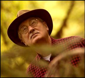


"I was on a panel in San Francisco several years with Jerry Franklin the eminent forest scientist now based at the University of Washington. So last month I took it on myself to write him the following question:
'When I talk to the Biodiversity Council in June, I would like to be able to say something like this: 'Long range sustainable forestry practices - that will support full biodiversity - and be relatively fire-resistant - and also be on some scale economically viable - over centuries - is fully possible. And what we must now do is search out and implement the management program that will do that.' Do you think I can say this and the science will support it? Any comments?'

Jerry Franklin immediately wrote me back,

'What you propose is totally and absolutely feasible for the Sierra Nevada. I.e., long-term sustainability, full biological diversity, relative fire resistance (low probability of catastrophic crown fire), and economic viability. A system which provides for restoration and maintenance of a large diameter tree component (with its derived large snags and down logs) and which provides for moderate to high levels of harvest in the small and medium diameter classes (allowing escapement of enough trees into the large diameter class to provide replacements for mortality in the large diameter group) and prescribed burning in some locations can do this. Other considerations include riparian protection and, perhaps, shaded fuel breaks. Economic and sustainable in perpetuity!' "

To quote SuperMario.... "Here weee g-o-o-o-o-o-oooooooo..."